As the world rapidly urbanizes, the amount of building in flood-prone areas is soaring, according to new research, sparking concerns about people’s vulnerability to disasters as the climate crisis escalates.
Between 1985 and 2015, the number of settlements – from small villages to mega-cities – with the highest flood hazard exposure increased by 122%, according to the study published in the journal Nature on Wednesday.
Researchers analyzed global flood hazard datasets and annual settlement footprint data covering the three decades between 1985 and 2015 to understand the populations most affected by flood risk.
They found over this period, as the world’s settlements grew by 85%, urbanization happened much more rapidly in high-hazard flood zones than in areas with low flood risk.
In 2015, more than 11% of built-up areas globally faced high or very high flood risk, meaning areas at risk of flooding depths of at least 50 cm (17 inches) during 1-in-100-year flooding events, according to the report.
Exposure to all types of flooding is increasing, but vulnerability to coastal flooding is increasing at the fastest pace, the report found.
The researchers concluded that flood risks are substantial across all regions of the world and all income groups, but some face higher risks than others. Exposure is highest in East Asia and the Pacific region, and lowest in North America and sub-Saharan Africa, according to the report.
Upper-middle income countries had the largest proportion of new human settlements in the highest flood risk zones, the report found. These results were driven by China, which has experienced very swift urbanization, and is home to nearly half of all new settlements built in high flood hazard areas between 1985 and 2015.
While higher income countries mostly saw relatively slow growth in flood-prone zones over the 30 year period, many – including the US, Japan and the Netherlands – already had many settlements in areas at high risk of flooding before 1985 and have had to spend large amounts to protect them, according to the report.
Why choose to build in flood zones?
There are many reasons why the amount of building on land vulnerable to flooding is shooting up, but scarcity is a major driver.
Land that is safer from floods has largely been built on already, meaning new development is disproportionately happening in floodplains and other areas that would have previously been avoided.
In Vietnam, for example, where around one-third of coastal land is built on, new developments are being forced into hazardous land, the report found.
Sometimes the economic opportunities are assumed to outweigh the risk of disaster, such as for major port cities, beachfront communities or tourist areas. Other reasons include a lack of flood data, poor urban planning or weak regulation.
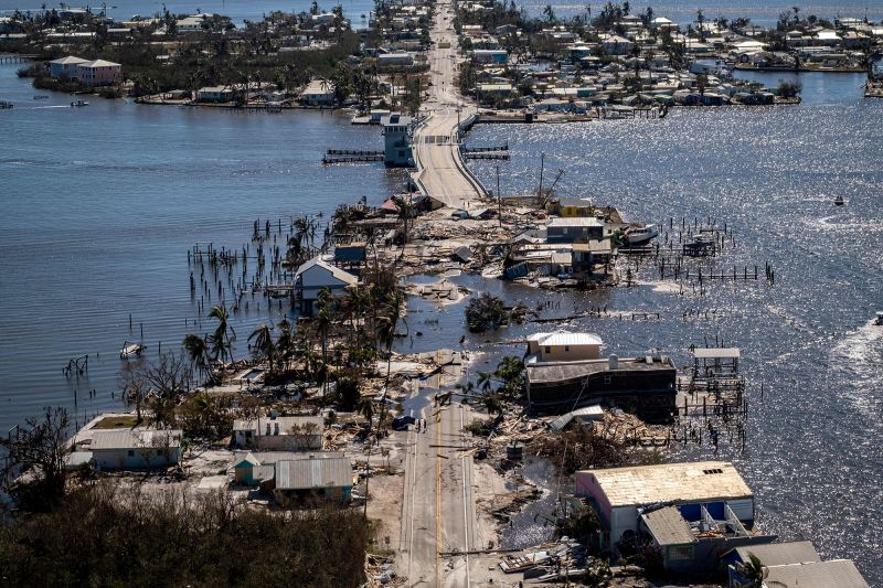
Southwest Florida, at risk from increasingly severe hurricanes, has seen populations explode due to its sunny weather and relative cheapness. That growth came as the state loosened regulations around building in high-risk and low-lying areas.
The report recommended a number of actions for policymakers and planners, including investment in disaster preparedness, early warning systems and evacuation plans in areas where flood risk is already high, as well as revising land use plans and building codes in areas where the risk is growing.
Robert Nicholls, professor of climate adaptation at the University of East Anglia who was not involved in the study, said the report’s methodology was robust and its findings were “new but not surprising.”
“This is concerning as development patterns are enhancing risk without climate change – climate change will further exacerbate these risks in the future.”


