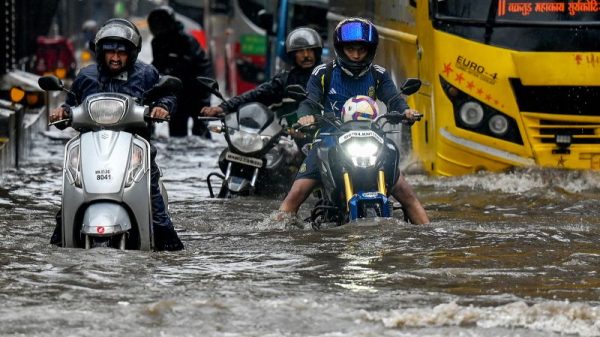
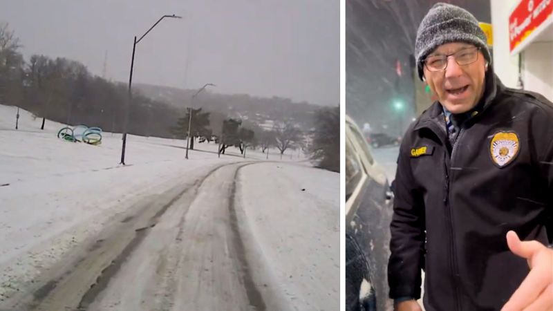
Millions of Americans from the Ohio Valley to the mid-Atlantic are bracing for a wintry Monday with heavy snowfall, ice, rain and storms, which are forecast to disrupt morning commutes, delay the start of school, and snarl airline schedules across the East Coast.
Meanwhile, the nation’s eyes will be focused on Washington, DC, Monday as the US House and Senate will meet in joint session to count each state’s electoral votes and formally declare Donald Trump and JD Vance the president-elect and vice president-elect, in the midst of a winter storm warning expected to bring snow mixed with sleet, with accumulations between five to 10 inches and isolated amounts of up to 16 inches.
Businesses and government agencies in the region are announcing closures, while just to the west, multiple states have already been dealing with inclement weather, shutting down major highways, like I-29 in Missouri, leaving people stranded. All told, the treacherous weather encompasses a 1,300-mile swath of the United States and has left more than 55 million people from Missouri and Arkansas to New Jersey and Delaware under winter weather alerts.
US federal government offices in Washington, DC, will be closed Monday due to the weather, according to the Office of Personnel Management, but the closure will not affect Congress.
DC Mayor Muriel Bowser told a news conference Sunday afternoon the top priority is getting the city fully opened as soon as possible and urged people to give snowplow teams space to work. “If you don’t need to be on the roads tonight and tomorrow, stay home. Please stay off our roads,” she said.
Behind the storm, bitterly cold air is settling across the Central US. Over 45 million people from Nebraska to Texas and east to Louisiana are under cold weather alerts, where low temperatures below freezing and wind chills below zero are possible. By Tuesday, temperature drops of as much as 30 degrees below normal for the eastern two-thirds of the US will lock in whatever snow and ice fall from the storm.
Weather alerts and forecasts for key cities
St. Louis, Missouri: Winter storm warning until 7 a.m. ET Monday, with mixed precipitations, additional snow and sleet accumulations of between three and five inches, and ice accumulations of up to one-tenth of an inch. Winds gusting as high as 35 mph will cause blowing snow.
Indianapolis: Winter storm warning through 7 p.m. ET Monday, peaking through 7 a.m. Monday. Additional snow accumulations ranging from two to five inches, while freezing drizzle over portions of central Indiana could lead to ice accumulations around a light glaze. Winds gusting as high as 40 mph.
Louisville, Kentucky: Winter storm warning through 7 p.m. ET Monday peaking until noon. Heavy mixed precipitation, with ice accumulations of up to a half inch and higher amounts expected near the I-64 corridor. Additional snow accumulations of one to two inches on Monday, mainly in southern Indiana and north central Kentucky.
Cincinnati: Winter storm warning through 11 p.m. ET Monday, peaking until Monday at 1 p.m. Additional snow and sleet accumulations are between four and six inches, and ice accumulations up to one-tenth of an inch. Winds gusts as high as 35 mph are expected.
Charleston, West Virginia: Winter storm warning through 1 a.m. ET Tuesday peaking between 1 p.m. Sunday and 5 p.m. Monday. Heavy mixed precipitation with total snow accumulations between four and eight inches along with ice accumulations between one-tenth and one-half inches.
Washington, DC: Winter storm warning through 1 a.m. ET Tuesday, peaking Monday midnight through 10 a.m. before wrapping up early Tuesday. Snow mixed with sleet is expected with total snow accumulations between five and 10 inches, with some suburban areas potentially getting up to a foot. A trace of ice accumulation is also possible.
Philadelphia: Winter weather advisory from 1 a.m. through 10 p.m. ET Monday, peaking between 6 a.m. and 6 p.m. Snow accumulations between two and four inches.
Richmond, Virginia: Winter storm warning through Tuesday at 7 a.m. ET, peaking Monday morning through 10 a.m. Heavy mixed precipitation, with total snow and sleet accumulations up to five inches along I-64 and between four and eight inches north of I-64 expected. Total ice accumulations between one and two-tenths of an inch.
Weather disrupts schools and travel
The governors of Kentucky, Virginia, West Virginia, Arkansas, Missouri and New Jersey declared states of emergency, while Maryland’s governor declared a state of preparedness.
The National Guard was deployed across major roads in Kansas, western Nebraska and parts of Indiana over the weekend, where hundreds of motorists were stranded by at least eight inches of snow and winds gusting up to 45 mph, the Associated Press reported.
At least 600 motorists were stranded in Missouri, while hundreds of car accidents were reported in Virginia, Indiana, Kansas and Kentucky, according to the AP.
There were 1,260 flight cancellations in the US early Monday as the storm moved through, according to the tracking website FlightAware.
Major effects, including “considerable disruptions to daily life … dangerous or impossible driving conditions and widespread closures,” are expected from the storm through Monday in parts of the Central and Eastern US, according to the Winter Storm Severity Index.
Schools on the East Coast to the Midwest, due to reopen Monday after the holiday break, will also likely face delayed restarts.
All public schools in Washington, DC, will be closed Monday due to weather conditions, the district said in a post on X Sunday. Alexandria City Public Schools and Arlington Public Schools in Virginia are also closed.
Cincinnati Public Schools, one of Ohio’s largest school districts, will close on Monday due to inclement weather, its website said, while some schools in Louisville, Kentucky and Springfield, Missouri, will also shut due to dangerous road conditions brought by icy rain and sleet.
Ice and snow bring down powerlines
The massive winter storm brought blizzard conditions to the central plains region Sunday leaving at least 230,000 customers across five states without power. The storm is expected to bring an “extensive” amount of snow to those in the Central Appalachians and mid-Atlantic area, the National Weather Service Weather Prediction Center said Sunday.
‘Significant icing’ expected
Meanwhile, an ice storm warning remains in effect until noon CST Monday for areas of southern Illinois, western Kentucky and southeast Missouri. Travel of any kind in those areas is “strongly discouraged,” as the bridges and overpasses are likely to “become slick and hazardous,” according to the Weather Service.
“We’re taking this really seriously, and I hope everybody else across America is too,” Beshear said Sunday.
The greatest risk of dangerous ice will set up just south of the snowiest areas. Significant icing is possible from Kansas and Missouri through the central Appalachians and potentially parts of Maryland and Delaware.
The National Weather Service said “significant icing” is expected.
On Sunday, a Kansas Highway Patrol trooper said in a post on X some “may be stuck for extended periods of time,” because of “untreated roadways and hazardous conditions.”
As blizzard conditions began in Topeka, Kansas, on Sunday, strong winds caused snow gusts throughout the area, as seen in video shared by the National Weather Service office in Topeka on Sunday morning.
Topeka’s 14.1 inches of snow – recorded on Sunday – is the third largest calendar day of snowfall on record, while Kansas City’s 10.8 inches is one of the top 10 snowiest days on record and the snowiest day since 1993.
“More of this can be expected through the day with drifting snow making travel nearly impossible. Stay home and stay safe,” the weather service in Topeka said on X.
The Kansas Turnpike Authority said at least dozen or so crashes happened Sunday and posted photos on X of some of the crashed vehicles near Andover.
On Sunday the Kansas Department of Transportation said “ALL highways in northeast Kansas, including I-70 from the Missouri state line west to the Ellsworth County line in western Kansas, are closed,” making it difficult for those to get around.
When he woke up Sunday, Cho said conditions hadn’t improved, but he is praying to God he can get home on Monday.
Storms in the south
Those in the South can expect rain and some embedded thunderstorms. The massive storm will finally exit the East Coast late Monday and fully diminish in impact overnight.
A tornado watch was issued Sunday until 9 p.m. for parts of Arkansas and Louisiana, while parts of Mississippi were on tornado watch until roughly 10:45 p.m. There were at least two confirmed tornadoes so far in the watched areas, with notable tornadoes occurring in Avery, Arkansas, and Pelahatchie, Mississippi. The severe storm threat weakens to a level 1 of 5 for Monday as it shifts to parts of southern Georgia and northern Florida.


